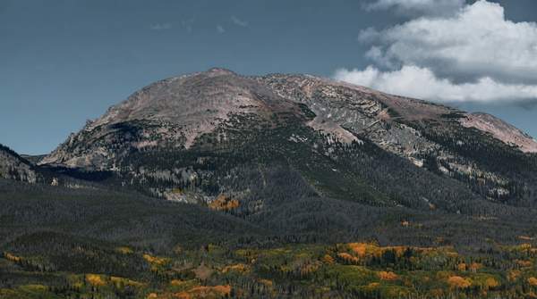
Summit County offers three distinctly different fall drives: Boreas Pass, a historic dirt road winding through aspen groves; Hoosier Pass, a paved climb to 11,500 feet with sharp switchbacks; and the Top of the Rockies National Scenic Byway, a longer route with expansive views of Colorado's fourteeners. The right choice comes down to how much time you have, whether your vehicle can handle dirt, and whether you prefer intimate aspen corridors or wide-open alpine panoramas. Here is how the three compare.
Discovering Summit County's Golden Season
Summit County's aspen display is famously brief. As Heather Jarvis wrote for Summit Daily, "the aspen leaves change suddenly and dramatically and then, in the same fashion, disappear. If you blink, you'll miss it." The town of Breckenridge's tourism office puts the best foliage window between mid-September and early October, with the sweet spot often in the last two weeks of September, though exact timing shifts each year with elevation and weather. Higher elevations change first, so color often appears before you even reach the county. A September 2026 Summit Daily report by Jessica Sachs confirmed foliage was already reaching its peak that month, with the town's online "leaf brief" listing Boreas Pass Road among the ideal spots to visit.
Boreas Pass Road: A Historic Dirt Adventure
Boreas Pass Road, a former railroad route turned dirt road, begins at the south end of Breckenridge and winds through golden aspen groves with panoramic views of Breckenridge, the Tenmile Range, and South Park. VisitBreck estimates the round trip at one to two hours. The pass sits at 11,488 feet, roughly 18 miles and 50 minutes from Frisco, with a gradual ascent to the summit. The road is usually passable through early October, weather permitting, and Best of Breckenridge's guide, authored by Lauren Parker, calls it the top pick for combining fall colors with local history. The Section House at the summit serves as the recommended photo stop, offering wide-open views of foliage in both directions.
Hoosier Pass: Paved Peaks and Panoramas
Hoosier Pass, reached by heading south on Highway 9 from Breckenridge toward US 285 and the towns of Alma and Fairplay, is the paved option among the three. The road climbs to 11,500 feet with sharp switchbacks and, in VisitBreck's description, "jaw-dropping views." The descent into South Park delivers a sweeping panorama of valley foliage framed by mountain peaks. The round trip runs an estimated 1.5 to 2.5 hours from Breckenridge. Because it is paved, it suits any passenger car, and the summit sign pull-off is the recommended stop for a high-alpine photo with aspens in the background. All drive times are estimates that will vary with traffic and stops.
Top of the Rockies Byway: A Grand Tour of Colorado's Peaks
The Top of the Rockies National Scenic Byway is the longest commitment of the three. Within Summit County it starts at Copper Mountain—about seven miles and 11 minutes from Frisco—and travels over Fremont Pass to Leadville, where travelers can continue to Granite or loop back via the extension through Tennessee Pass, Camp Hale, Red Cliff, and Minturn to Interstate 70 east. Carly Holbrook, former spokesperson for the Colorado Tourism Office, told Summit Daily: "That's a gorgeous drive. There's a lot of aspen on that route and a lot of wide-open spaces where you get expansive views of 14ers and fall colors." The byway's highest point reaches 11,319 feet. No single round-trip time from Summit County is specified, but its multi-pass routing makes it a longer excursion than the other two.
Planning Your Fall Foliage Drive: Timing and Vehicle Tips
Timing matters more than route choice: aim for mid-to-late September, when the last two weeks of the month typically deliver the strongest color, and remember the peak is brief. On vehicles, the Best of Breckenridge guide's core advice is to choose a route that matches your car—never take a low-clearance passenger car onto high-clearance 4WD or OHV roads such as Mosquito Pass or Georgia Pass. Boreas Pass is a maintained dirt road generally suitable for most two-wheel-drive vehicles in summer and fall, though conditions vary with weather and winter travel requires four-wheel drive, all-wheel drive, or chains under Colorado's traction law. Hoosier Pass and the Top of the Rockies route are paved and accessible to ordinary cars. This article does not provide real-time road conditions or closure information, so check current status before setting out.
Summit County Fall Foliage Drives: A Comparative Guide
The table below aligns the three routes on the same decision factors—route type, estimated time, road surface, and key viewpoints—so you can match a drive to your schedule and vehicle in one glance. Times are round-trip estimates from the Breckenridge or Frisco area and will vary with traffic and stops.
| Route | Route Type | Estimated Drive Time | Road Surface | Key Viewpoints/Features |
|---|---|---|---|---|
| Boreas Pass Road | Historic former railroad route climbing to 11,488 feet | 1–2 hours round trip from Breckenridge; about 50 minutes one way from Frisco | Maintained dirt road, generally passable for 2WD in summer and fall; usually open through early October, weather permitting | Golden aspen groves; views of the Tenmile Range and South Park; the historic Section House at the summit |
| Hoosier Pass | High-elevation paved pass climbing to 11,500 feet | 1.5–2.5 hours round trip from Breckenridge | Paved; accessible for 2WD vehicles | Sharp switchbacks; sweeping panorama of South Park valley foliage; summit sign photo stop |
| Top of the Rockies Byway | National scenic byway connecting multiple passes, up to 11,319 feet | Longer excursion; no single round-trip time specified from Summit County | Paved byway starting at Copper Mountain, over Fremont Pass to Leadville, with an optional loop via Tennessee Pass | Expansive views of 14ers and fall colors; aspen stands and wide-open spaces through Camp Hale, Red Cliff, and Minturn |
Making Your Decision: Which Drive is Right for You?
The comparison points to three clear profiles. If you want historic charm and an intimate drive through aspen groves, and your car can handle a maintained dirt road, Boreas Pass is the pick, deliverable in one to two hours from Breckenridge. If you want dramatic paved switchbacks and a high-alpine summit without worrying about road surface, Hoosier Pass fits any vehicle in roughly 1.5 to 2.5 hours round trip. If you have a half day or more and want the grandest scenery—expansive views of fourteeners along a route praised by the Colorado Tourism Office's former spokesperson—the Top of the Rockies Byway is the choice. All three are accessible from Summit County, and none requires four-wheel drive in fall conditions, though Boreas Pass demands a bit more tolerance for dirt.
Your Perfect Fall Drive Awaits
Choose a scenic drive that aligns with your vehicle's capabilities and your desired time commitment, aiming for mid-to-late September for peak colors. The measurable indicator to watch is the presence of vibrant golden aspen leaves across Summit County, typically in mid-to-late September. Because the display arrives suddenly and disappears just as fast, plan your Boreas, Hoosier, or Top of the Rockies trip for the last two weeks of September, and be ready to adjust if the color turns early—once the gold fades, these routes lose the foliage that makes them special.
Sources
- FALL FOLIAGE SCENIC DRIVES AND PHOTO STOPS NEAR BRECKENRIDGE — Visitbreck
- Fall foliage is reaching its peak across Summit County. Here’s where to see the best colors. — Summitdaily
- 7 Best Breckenridge Scenic Drives: Routes, Maps & Winter Tips — Best of Breckenridge Blog
- Top 6 drives to see fall foliage near Breckenridge, Colorado (with video) — Summitdaily